Sunday, February 17, 2013

Puerto Deseado

Our latest trip: Puerto Deseado (S47.45 W65.55)

At the end of January we went back to the USA to visit our family, refresh our family ties, and see our friends. We flew to Buenos Aires, Argentina and from there to Trelew to pick up our car parked at my uncle's house. After resting one day we continued South to Puerto Deseado, a small city located South of Golfo San Jorge. Before leaving Argentina we had arranged to meet in Puerto Deseado with members of birdwatchers clubs from other parts of the country, so we found people from Puerto Deseado, Comodoro Rivadavia, Sarmiento, and Esquel.

We knew that this area was a good spot for watching birds of all sorts, but the place exceeded our expectations. The city is located at the mouth of the 'ria'. The river running from the mountains
dried out some 12000 years ago and the coastal area subsided giving way to an invasion of the sea over the former river bed. Consequences: the sea inlet now spread for some 30 miles into the continent bringing with it all sorts of marine life, including penguins, cormorans, seagulls, petrels, dolphins, and seals.

We first day we took a boat to Penguin Island, some 15 nm Southeast from Puerto Deseado. Apart from adventurers from Spain, England, and Holland, the island was first occupied by a seal oil factory. The Spaniards started the operation around 1790 and killed some 30,000 seals per season. A few years later they stopped it probably because the seal population was exhausted.

The first thing we saw approaching the island was the old lighthouse. Built in 1903 by local prison inmates it is now out of service. Most of the island is populated by Maguellan penguins, but there is also a significant colony of Rockhopper penguins. On the other side of the island there is a male seal colony, those that are either too old or too young to mate, including an elephant seal. Among the flying population we saw a variety of gulls, terns, skuas, petrels, swallows, and cormorants. The round trip to the island takes about one hour. It was quite cold, but the weak sun and the strong wing gave us a splendid bright red suntan of which I am still recovering.

The second day the boat took us westward through the ria. Now we got closer to the cormorant's nests, built on the cliffs facing the ria. There we saw the imperial, real, gray, and black cormorants, each one nicer than the other. There is an important population of Commerson's dolphins and one of them came to play around the boat. Unfortunately I could not take any good picture of them. Along the ria we also saw plenty of Maguellan penguins, seagulls, and seals.

In the canyons along the ria there is a colony of owls (Great Horned Owl). This is the largets of all owls and we had several nearby possing for us.

I found a good video of Penguin Island on the web. You might enjoy spending some time with it.

The trip back to Esquel was long (some 12 hours) and tiresome. We are still trying to recover from so much boat and car punishment but happy for the adventure.
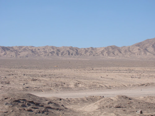


A view of the ria.


A couple of Rockhopper penguins


A young Rockhopper ready to go fishing


Another Rockhopper in the process of changing feathers


Red-legged cormorant


A Black Oystercatcher


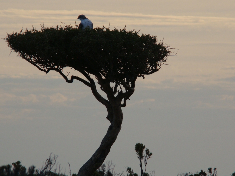
A falcon nesting on top of a bush


The Great Horned Owl is the largest of the family, some 50 cm tall.


A Black Widow waiting for us in the bushes.


This is part of the colony of male seals


Kelp gulls and a youngster


South american terns


Magellan penguins with the Penguin Island lighthouse in the background.


A Black Cormorant

Sunday, October 28, 2012

Catching up


Well, it took me some time to continue posting on this blog.
It is not that I am lazy. Quite the contrary, I am a very active person but there is a time for everything, and I hope this is a good time to narrate my adventures.

As you know, we moved to Esquel, in the Northwest corner of Chubut province, Argentina. This is not a very big place, some 35000 people, but it is full of attractions. The city has many activities and shows that  keep us busy the entire week. In addition, Esquel is in the foothills of the Andean Mountains, so we are surrounded by mountains, lakes, rivers, trees, and vegetation of all sorts. 

We are also engaged in two other activities that take much of our time: birdwatching, and the popular protest against mining activities.

Birdwatching is fantastic because of the big variety of birds in our province, but it also allow us to meet interesting people and know the area.

Regarding the popular protest against mining activities, you might be aware that the world is currently being destroyed by big mining companies eager to grab minerals regardless of the environmental and social impact. In Argentina, both the central government and provincial governments are in the forefront of the sellout to mining interests. Accordingly, they gave the authorization for mining exploration and exploitation in many provinces of our country. Of course, it is easy to make such decisions when you live hundreds or thousands of miles from the mine sites and it is not your kids but someone else's that get the contamination. We are currently trying to stop the contamination and the depletion of water resources in our province. Our city is apparently saved from the destruction but now they targeted the central plateau, so there is always a reason to be on guard against the mining companies and its allies in the government.

Here you have some pictures of our province, and hopefully this will convince you to come visit some time.


A view of the petrified forest, near Sarmiento in South Central Chubut.
This place was covered by dense forests some 65 million years ago, then it sunk under the sea for some million years where it suffered the petrification process. Later on, a few million years later, it emerged again.

Another view of the forest place


An example of a petrified tree.


Near Lake Rosario, about 45 minutes South of Esquel


A view of Lake Rosario


The Central Plateau, about 60 miles East of Esquel. River Chubut on the forefront.


A pond near Trevelin. We visit the place to watch the many aquatic birds.


A Loica


Pato Barcino


Patos maiceros


Pato overo - female


Royal woodpecker - female


Royal woodpecker - male


Aguila mora after breakfast. Notice the detail on the beak and fingers.


Bandurrias

Sunday, September 16, 2012

Just a test

This is just a test. If this work then I will try to give new life to my blog.

A view of Northern Chubut province, on the road to Piedra Parada.

Thursday, March 22, 2012

Wrap up and learned lessons

We finished our trip and we are glad that we dared to make it. It was not as difficult as we thought before departure. In fact, having a car in good conditions and your papers in order, the only thing that is needed is a credit card and the will to keep moving forward.

We planned our trip based on the available information, and this proved to be way too conservative. As a consequence we overestimated the risks, carrying stuff such as clothes and tools that were not needed. On the other hand, I failed to anticipate how difficult would it be to drive in the mountains of Colombia. I should have changed the brake fluid ahead of time, and this problem affected us while at the top of the mountains. In any case, it is never too late to learn new lessons.

Our only guide was a set of standard paper maps covering the entire continent. We did not have a GPS or even a cell phone, and we didn't need either of them. Alicia is now an expert interpreting maps, and thanks to her we didn't get lost more frequently. The biggest problem was driving inside the cities. Streets usually have their names on the map, but not posted on the street itself, therefore finding our way around was normally a serious challenge.

We were warned before departure about the risks of such a trip, with emphasis on certain countries having a bad record. However, we didn't experience a single incident. Not only that, but we were treated very well everywhere we went. Of course, we kept a low profile and that helped us, but we drove through all sort of roads and into smaller towns out of the beaten path all without a single problem. Based on our experience, all the warnings issued in the USA are completely out of proportion and should be disregarded.

Initially we felt like heroes trying to do some unbelievably daunting task, but once we started crossing countries and borders we realized that we were not alone in such a trip. There is a whole crowd of people actually driving throughout the continent, most of them from Latinamerican countries and Europe, and almost none from the USA. This is sad because people is unnecessarily affected by the negative advertising by the US media and government agencies.

In a trip like this you always have the opportunity to meet very interesting people and share their experiences. We were fortunate enough to meet people from different countries equally interested in learning as much as possible about Latinamerica, and we hope to see them again someday.

Regarding roads, our experience was mixed. The Panamerican Highway is in good shape with very few potholes. However, we choose to drive on secondary and minor roads, and in some cases we also drove on roads in construction. In those cases we exposed ourselves to some bad roads and, as consequence, we now need to replace the four shock absorbers in our car.

The best drivers are in Mexico. All seem to be well trained, and we felt very safe driving there. Chile is a close second in our ranking, also helped by their good roads. At the other end of the scale are Peru and Colombia, where everybody drives like a maniac. We are also feeling insecure in Argentina, where everybody drive unnecessarily fast.

We lost valuable time waiting for our car in Cartagena, Colombia. After that we decided to eliminate part of our tour through Colombia. Not only that but we also bypassed competely Machu Pichu and Bolivia. Our plan is to come back in a future trip to these parts of the world, which from Argentina will be a feasible trip.

The highlight of the trip was our sea voyage from Portobello, Panama, to Cartagena. I recommend it to everyoneprovided that you are equipped with motion sickness pills. Our journey through the San Blas Islands and later the high seas sail to Cartagena will remain for a while in our memories.

Finally, a word about iPad. We bought it hoping that it would save us some bulk and help us expedite our record keeping. It effectively is light and easy to carry around and, considering that we bought a refurbished one, worked without special problems. The iPad is designed to extract data from the Internet and is very good at that. However, as a data entry tool is extremely crude. The digital keyboard has limited functionality and handling pictures is more cumbersome than in a normal PC or MacBook.

Not all applications were upgraded to work on the iPad Operating System. For example, we found during the trip that Blogger, which we selected to create our blog, would not allow us to uplink pictures. That alone costed us bitter tears until we bought Blogsy, another application which allowed us to uplink pictures with some extra work.

Overall, had I known the iPad limitations, I would not have brought it in our trip.

To close this blog, thanks very much to all of you who wasted time reading about our adventures. We deeply appreciate your comments, and we always felt accompanied by you.

Your humble servants,

Alicia and Roberto


Some cactii in central Chile


Volcano Villarrica, South of Temuco


The seaside near Valdivia, a great place in Southern Chile


Going from Chile to Argentina we drove by the Puyehue National Park. The volcano Puyehue is the one that erupted last year and filled with ash most of Southern Argentina. Early in the morning we saw the ash piling up by the roadside on the Chilean side.


This used to be a blue lake on the Argentinian side. Now it is full of volcanic ash.


This is one of the first images we received from Argentina. The mountains peaks are more abrupt, also displaying the efect of the volcanic ash.


We entered Argentina by the Samoré Pass. After driving through Villa La Angostura, we had our first sight of the beautiful lake Nahuel Huapi, near Bariloche.

Saturday, March 17, 2012

Well, we made it after driving some 13400 miles. We are now at our final destination, Esquel, and taking a little rest before starting our search for a rental house. I will post further comments in my next blog. Thanks for following us... Roberto

Thursday, March 15, 2012

Down to Temuco

From Arequipa to the border with Chile we had 6 hours of easy driving. The border crossing was a little bit longer because of delays on the Peruvian side, but we got to Arica, on Norther Chile early enough to look for an hotel.

Arica is a nice little city, so far away from the nearest Chilean city that they end up dealing more with its counterpart Tacna on the Peruvian side. In fact, Arica used to belong to Peru until the 1880's, when Chile defeated Peru in the Pacific war. Chilean people is great and we had a good time there.


In Arica we learned about the problem they now have with antipersonnel landmines. Pinochet, the last dictator, was so imbecile that he ordered to put landmines in the mountain passes with Peru and Argentina. The global weather change now produced big rains that cleared the mines and dragged them down the rivers, close to the international routes joining Chile with Peru. According to what they told us, some of these mines already exploded and people is affraid of working in the affected areas. As a consequence, they had to close the border for some days and work on clearing the mines. We saw some of the special landmine cleaning equipments by the roadside.


The following morning we went to the Anthropology Museum of the University of Tarapaca, near the city of Arica. This museum has an outstanding collection of organic material from thousands of years ago, including mummies, clothes, baskets, and grains. The weather in this part of the world is extremely dry, therefore organic material does not corrupt and keeps preserved through the years. This is one of the best museums so far. We liked not only the type of material they have to show, but also the organization of the museum and the explanations next to each exhibit.


The Atacama desert starts in Peru and extends well past Antofagasta. Around Arica it is composed of plateaus some 15 to 20 miles long, followed by a long descent into a valley usually fed by a river, and then climb again into the next plateau. The lanscape is great, and makes driving very exiting. This continues almost until Iquique, the next city South of Arica.


We didn't expect Iquique to be such a big city, but it certainly deserved more time than we spent there. We just took a walk on the old center and had a great sea food meal with a couple of pisco sour drinks (something equivalent to a margarita but even better), and then we went to sleep in a happy state of inebriation.


From Iquique we had a long drive to Antofagasta, and then to Copiapo. It was almost 12 hours behing the wheel because we choose the longer route through the desert, instead of the coastal road. We expected the desert to be as intesting as the previous day but were disappointed. At these latitudes the Atacama desert runs mostly flat between distant mountains, without much to call our attention.


We finally arrived to Copiapo, and you might remember that this city was at center stage a couple of years ago when the Chilean miners got trapped in the mine. In the main avenue there is now a beautiful statue donated by the Chinese people to conmemorate the miner's rescue. At this point we stopped and wonder what are the Chinese doing here? After all, they didn't participate in the rescue, and their mining record is probably worst than the Chileans.


We were unable to visit the mine because it is private property and they don't want tourist making stupid questions, so next day we moved South to Valparaiso. This is one of the oldest cities in Chile, with a rich history. We arrived to Valparaiso quite late, driving through the nearby modern city of Viña Del Mar. The hotels that we found at that time were either too old and creepy, or too expensive, so, after some consideration, we decided to drive through the night and move farther South to Temuco. From Temuco we will go to Vilarrica, Pucon, Valdivia, and, finally, Osorno, our last Chilean city before crossing to Argentina.


Some samples from the Anthropology Museum of the University of Tarapaca, in Arica. Outstanding pottery from the Aymara culture.


I liked their collection of hats. Some of them with a simple, rounded top, but many terminated on a 4-cornered flat top.


This gentleman went to the other world with a much decorated turban.


before developing hats they used plain turbans, as in this picture.


This is the statue donated by the chinese to the town of Copiapo.


A valley between plateaus, South of Arica.


The long road ahead of us.


Another valley, With the road by the middle of the mountain on the right side.


A closer look at the mountains.


Between Iquique and Copiapo we could see many geogliphs, like the one in this picture.


A view of the desert, South of Iquique.


Still more of this unending desert.


Another look...

And, just in case you still like deserts, here is a final picture.